Biomass
Specifically, the satellite will assess “terrestrial carbon stocks and fluxes from an altitude of 666km above the Earth”. And it is due to launch today (10:15am BST, in French Guiana). You can watch it live on the European Space Agency website.
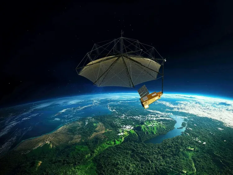
Dubbed Biomass, the space craft has been designed and built in the UK by Airbus Defence and Space.
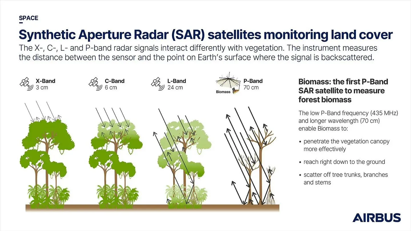
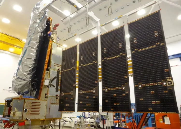 The idea is to use latest technology to help inform climate change policies. Specifically, the spacecraft will carry the first P-band (435 MHz) synthetic aperture radar (SAR) in space. The deployable antenna measures 12×15 metres to capture the reflected SAR data. This will provide accurate global maps of tropical, temperate, and boreal forest biomass.
Data on changes in biomass due to forest loss – for example from logging industry – and regrowth is unattainable by ground measurement techniques. Hence the need for a space-based viewpoint.
Flagship mission
“Biomass is a groundbreaking mission that will advance our understanding of how carbon is stored in the world’s forests – delivering crucial data in the fight against climate change,” said Kata Escott, MD of Airbus Defence and Space in the UK.
“With more than 50 companies involved across 20 nations, the team in Stevenage has shown exceptional leadership in delivering this flagship ESA mission.”
Carbon cycle
The UK Space Agency (UKSA), has been highlighting the project ahead of its imminent launch on the Avio-developed Vega-C rocket. It will operate in orbit for five years.
“The Biomass satellite represents a major leap forward in our ability to understand Earth’s carbon cycle,” said Dr Paul Bate, CEO of the UK Space Agency.
“By mapping the world’s forests from space in unprecedented detail, it will provide critical insights into how our planet is responding to climate change – helping scientists, policymakers, and conservationists take informed action. We’re proud of the leading role the UK has played in this important mission.”
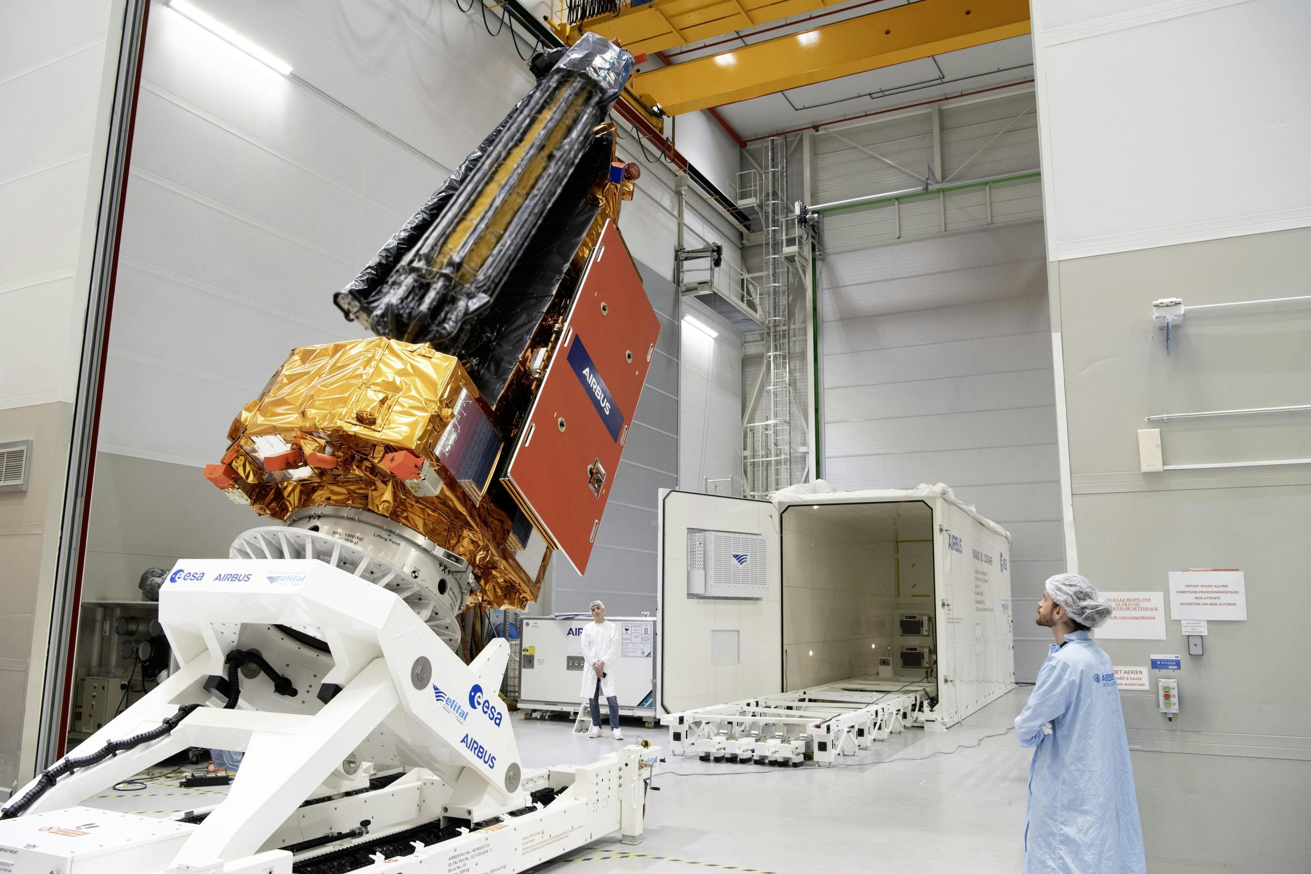 The forest measuring satellite shipped (right) to Kourou in French Guiana in February this year.
According to the UKSA, the project has supported 250 skilled jobs at the Airbus site in Stevenage. The agency also cites the UK’s space workforce as numbering 52,000.
Image: Airbus
See also: UK Space Agency awards SatixFy £1.8m for LEO payload software